Route
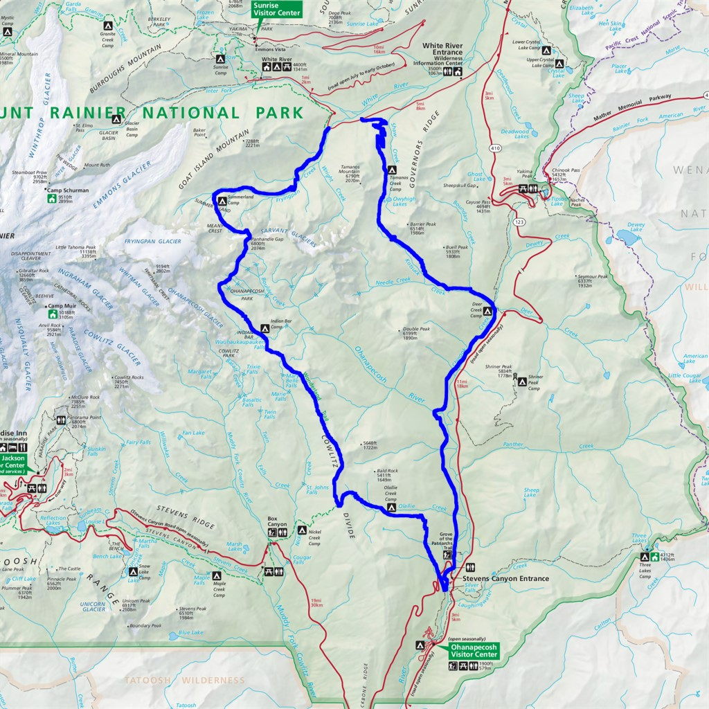 |
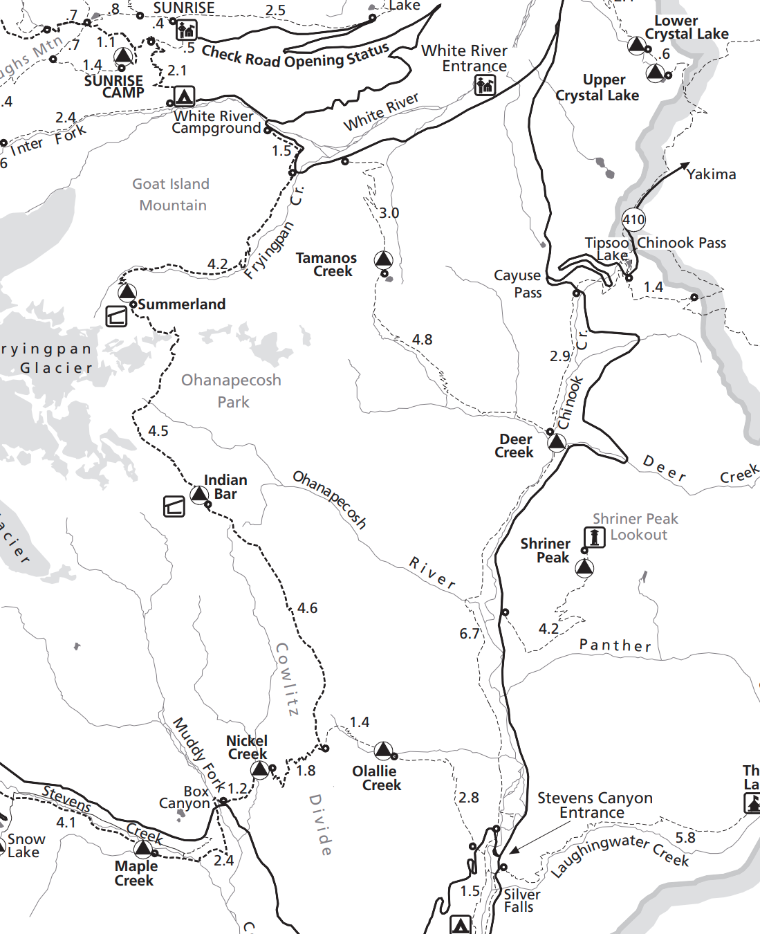 |
Background
I booked this trip in March with an itinerary of four nights because I had difficulty with the scheduling tool on recreation.gov during the early access booking period (somehow I won the Mt. Rainier early access booking lottery but I have been denied Enchantments lottery counting seven years straight). Five days is way overkill for a 35-mile trip. I do not want to spend more time sitting around than hiking. The two unknowns leading up to the trip were 1) if I could get the itinerary changed and 2) hit-or-miss fall weather.
Fast-forward to October, Seattle was experiencing one of the nicest early falls I can remember. I was ecstatic to see a week of blue skies and low 60’s weather, so I knew the trip was on. Unfortunately, the weeks leading up to the trip I was unable to reschedule on recreation.gov. And, to make matters worse, the government shutdown added additional uncertainty.
Days before the trip, I received an email saying the route was still open and that I could “activate” my permit at the White River Wilderness Information Center in person the day of. I was crossing my fingers given late in the season, plus the shutdown, I would be able to reschedule this trip for just two nights. Otherwise, I would just have to take my chances and bum a site if full.
Day 1
Frying Pan Creek Trailhead → Indian Bar (9 miles, ~3600 ft. ascent, ~2300 ft. descent)
I arrived at the White River Wilderness Information Center at 8AM. Somewhat to my surprise, it was open and there was a ranger inside to assist me. Luckily, I was able to swap the itinerary without a problem. I was slightly worried about conditions up at Panhandle Gap right past Summerland due to snow (I did not bring spikes or anything like that), but the ranger reassured me it was completely snow free.

This loop starts at Frying Pan creek where it meets the Wonderland trail (for reference, the Wonderland is a 93-mile trail that circles Mt. Rainier). The first part of this loop has you going south down the Wonderland and the second part north up the Eastside trial back to the beginning. You can park either directly at Frying Pan, or if you would rather walk ¾ a mile on the road to start the trip, you can park up the road at Owyhigh trailhead where the loop will spit you out. Eager to get going, I opted to park at Frying Pan creek so I could get on the trial immediately.
The ascent up Summerland was gradual and pleasant. There are a few narrow stream crossings and within two miles, Mt. Rainier begins to barely pop out through the forest trees. I was thrilled with the weather and looking forward to my future views. I passed a few older gentlemen who were day hiking along the way. Before I knew it, with fresh legs and a clean sheet of sweat, I arrived at the Summerland meadows where I took a seat in the shelter to admire the weather and the views. The group I passed caught up some time later and we made light chat about our plans. While I ate a snack, I secretly listened to them discuss their favorite musicians and jazz clubs they used to frequent. It was entertaining hearing them talk about their youth and I felt comforted by them.
Through the meadow, the view of Rainier and Little Tahoma was crystal clear. Rainier had a light cloud of mist hovering just above its summit.

Stunning views of Rainier from Summerland.
|

Rainier peaking out on the way to Summerland.
|
I packed up quickly and began ascending towards Panhandle Gap. The terrain quickly turned rocky and rugged. A bit of route finding was required, but nothing too difficult. There was one stream crossing which I assumed, at some different point in the season, may be harrowing or impossible to pass, but was now dismissed to just a small creek. As I approached the pass, I spotted two trail runners going back and forth with selfie sticks trying to get the perfect reel at the top. I chuckled and thought that would probably be good content!
The next part of the hike is the descent down into Indian Bar, a scenic subalpine meadow cut by the Ohanapecosh River. The landscape is dramatic: high ridges, meadows of wildflowers, waterfalls, cliffs, and river terrain combine for a striking alpine environment. It also features a rustic trail shelter built by the Civilian Conservation Corps in 1940. This place has special significance to me because in my teens my dad and I spent a night backpacking here together. Those trips with him are among my favorite memories and helped shape who I am today. I thought about him more than usual during this trip.
As I began the descent, the clear blue skies from earlier in the day had given way to a growing haze. Smoke from the Wildcat Fire near Bumping Lake drifted in from the east, casting an ominous tint over the landscape and changing the mood of the afternoon. Still, it was an awesome view of Indian Bar descending in where you can see the meadow and shelter far in the distance before you get there.
I arrived around 3PM with plenty of time to kill. Amazingly, this was my first solo-backpacking trip, and I was little worried I would be bored with downtime if I arrived at my destinations too quickly. Of the four campsites available, the best one was taken, but I still got a nice spot. I set up my camp on a cliff overlooking the bar with a bit of anticipation hoping I did not forget anything. All was good. Feeling tired, I slipped into my tent and let my mind ponder my life the past year, choices I have made, how I had enjoyed time here with my dad before at a different stage in my life, and how I was proud I was out here making time for myself. My mind swapped between reflection and nothingness, thoughts coming and going, until I eventually drifted to sleep for an hour. I guess that is how you kill time. When I woke up, my sleeping pad was partially deflated; I knew this annoyance I would need to live with the next two nights.
The rest of the evening was mostly business. Eating dinner down at the bar, washing up, and filtering water. Two other backpackers rolled in late filling up the remaining two camp sites. Both looked exhausted. I noted that I would have been okay without a permit, but just barely. As the sun went down and light receded from the meadow, I spotted a black bear not far in the distance behind the shelter who appeared to be foraging in a small permitter. Even though I knew I wouldn’t need it, I was happy I brought bear mace and decided to keep it right outside my tent. For dinner, I had Backpacker’s Pantry Green Curry, packing an impressive 2000mg of sodium. I was reminded why I usually avoid such high sodium meals at night, because it makes me pee a frightening number of times. I think I counted 4 times before bed and 3 times overnight. Not exactly what you want to be feeling or doing once you are cozy in your tiny tent.
I retreated into my tent around 7PM and was out by 7:30PM. That is amazingly early, if you know I almost never go to bed before midnight. I love how backpacking resets you like this. That night, I dreamed a lot as I often do when I’m backpacking. They weren’t ordinary dreams, but vivid ones that clung to me for a while after waking, only to fade again later. I’m always struck by how fragile memory is and how even the moments that once felt unforgettable eventually blur into almost nothing. I first woke in the night to a glow pressing through my tent walls. Half-asleep, I wondered if dawn had come early, but my phone read 1AM. Outside, the full moon hung perfectly between two trees, spilling silver light over me bright enough to walk by without a lamp. It was a very cool sight to see.

Crossing the Panhandle Gap.
|

Climbing to the pass to begin the descent to Indian Bar.
|

It got smokey on the way to Indian Bar.
|

A view of Indian Bar.
|

Indian Bar at sunset.
|

The best place to shit at Indian Bar.
|
Day 2
Indian Bar → Deer Creek (17 miles, ~2700 ft. ascent, ~4900 ft. descent)
I woke refreshed at 6:30AM, though the sky was still dark. Today would be my longest day on the trail, and I was eager to get moving. My sleeping pad had failed me again and was nearly flat by morning, even after I’d re-inflated it twice during the night. I ate breakfast perched on my bear canister, watching as the first light spilled into the Indian Bar.
This day would unfold in three distinct parts: first, the ascent south out of Indian Bar; second, the descent to the junction where I’d leave the Wonderland Trail for the Olallie Creek Trail; and finally, the eight-mile trek north along the East Side Trail to Deer Creek.
The ascent out of Indian Bar was easily the most spectacular part of the trip. The smoke from the day before had cleared, and the morning sun was so bright I could barely see, even with sunglasses on. About thirty minutes into the climb, the views opened up: Rainier towering behind me, Adams out front, and a sea of mist-draped peaks all around. I felt a sense of gratitude to be in such beauty, blessed with perfect weather and complete solitude. This was the kind of alpine magic that draws people back again and again.

Misty mountain tops.
|

The view of Rainier ascending out of Indian Bar.
|
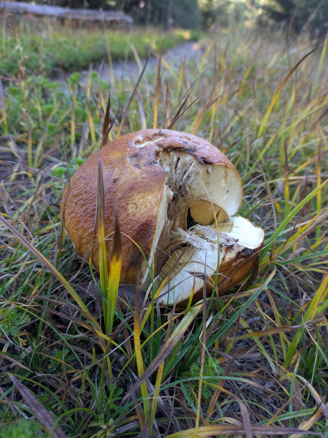
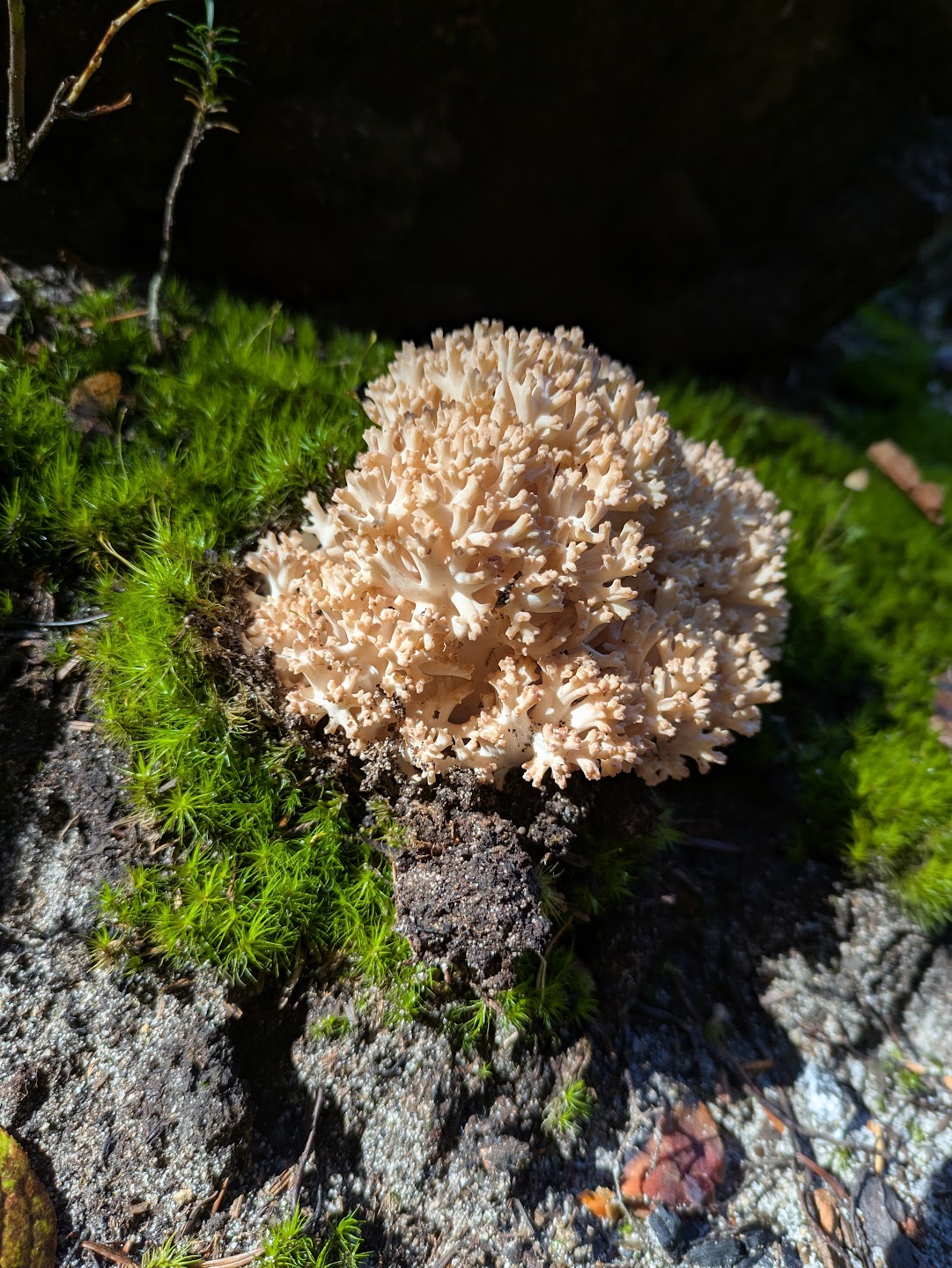
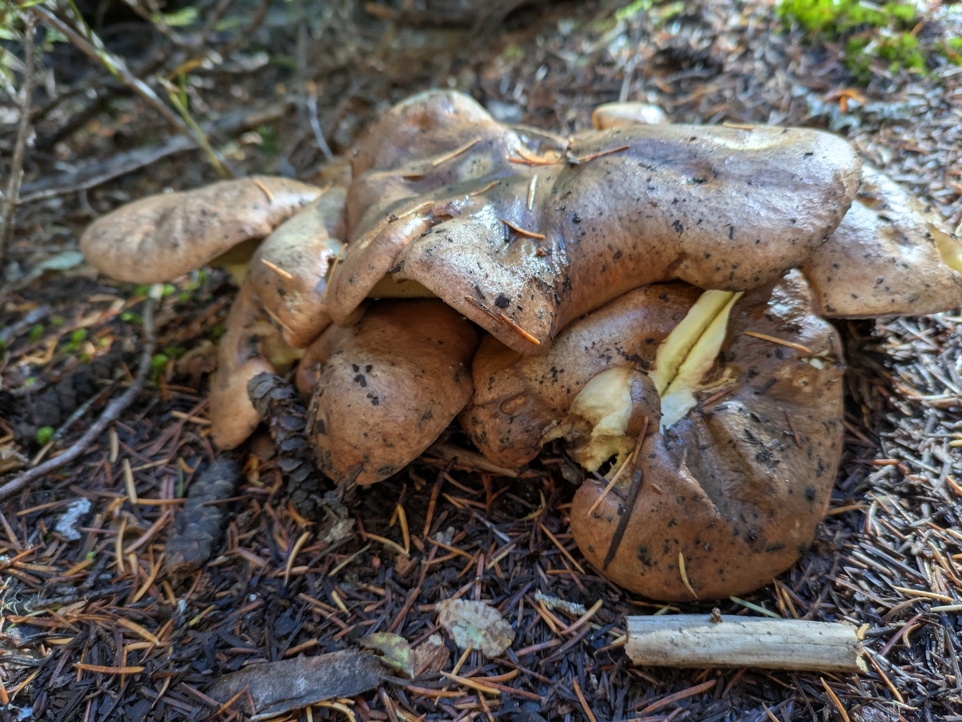
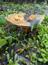
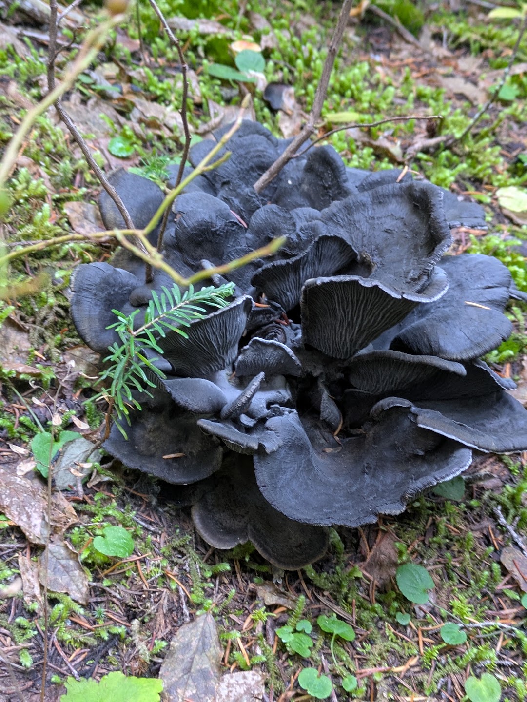
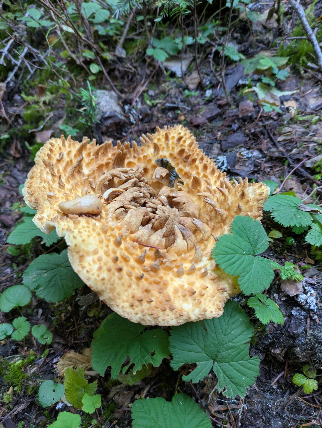
As the views faded and the descent began, I can’t say the hike to the East Side Trail junction was particularly memorable. I mostly put my head down and kept moving. What did catch my attention, though, were the countless mushrooms along the trail—every shape and size imaginable. I stopped often to take photos, amazed by their variety.
|
|
|
|
|
|
The junction with the East Side Trail was a bit tricky to navigate, involving a highway crossing and several turns. Because this section connects near the popular Silver Falls area, I finally started to see a few people: day hikers who had wandered a short distance from their cars to view the falls.
From there, the hike north along the East Side Trail was pure enjoyment alongside a river. The path followed the river closely, weaving past rock formations, waterfalls, and a few bridge crossings. The early afternoon sun was bright, the air warm, and the autumn colors more vivid at the lower elevation. As sunlight filtered through the trees and leaves drifted down around me, I felt again sense of gratitude for being out here. Even though I was tired, the energy returned, and I pressed on.
A side path led me to a hidden pool—a near-perfect watering hole framed by trees and stillness. I sat down for a long break, eating a small snack as a breeze passed through the valley. Pine needles rained from above, spinning in the light before settling on the water and drifting downstream.

No one else appeared on the trail or at Deer Creek. The campsite was plain, set back from the water, but solitude made it feel right. I ate dinner by the river’s edge, the sound of the current filling the space where thoughts might have been. After seventeen miles, weariness replaced reflection, and I retreated to my tent around 7PM.
The leak in my sleeping pad had worsened, and I finally found the hole right around the valve where you blow it up. I should’ve brought a patch kit! In a desperate attempt, I tried sealing it with medical tape, but that didn’t work. My next idea was to place my pillow (a compression sack of clothes) directly over the hole to keep the air from escaping. Guess how that worked? I spent most of the night on a deflated pad. Somehow, I still managed to sleep quite well.
Day 3
Deer Creek → Car (9 miles, ~3000 ft. ascent, ~1800 ft. descent)
The last day was all business. I woke at 6:30AM, ate granola with powdered milk and coffee, and was hiking by 7:30. I planned to push through the 3,000-foot, 4.5-mile climb and reach the car by 11.
The climb to Tamanos Creek was cold and misty. I kept my jacket on and my hands covered. Thick clouds hid any view of Rainier or surrounding mountains so I just focused on moving steadily up the long series of switchbacks. At the top, the fog lifted and the sun came through, lighting up the meadows. One meadow had a large lake in the distance before starting the final descent—a smooth, wide trail that made for the easiest hiking of the trip. I had to hike a bit of road at the end, but I reached the car at 10:45, ahead of schedule.
It always feels great finishing a trip. I turned on some music, ate the cheese I had left waiting for myself, and enjoyed the drive back to Seattle.

Day 3 saw a dramatic change in the weather. Mist was everywhere!
|

A view of the meadow with a lake near Tamanos Creek.
|
Other Notes
- Gear: I was quite happy with my gear overall besides my failing tent pad. Note to self to bring a patch kit for the future, or just buy a higher quality pad. As usual, I overpacked on clothing. Normally I think it is wise to bring one shirt and pair of socks per day, but unless I get really sweaty, I rarely switch these out. I wore the same shirt the entire time and subbed socks just once. I brought a few other items I never wore, like a hoodie. My pack was around 35 pounds with the extra clothing, bear cansister inside, and bear mace adding additional weight. I carried 2.5 liters of water.
Shout out to my Katadyn 3L water filter. I have tried many other filters like traditional pumps, Sawyer Squeeze, radiation pens, and the Katadyn wins. It is really easy to fill the Katadyn filter up in the water and then all you need to do is hang (or hold it) it from a branch and it fills your bottles almost immediately. Maybe the best part is it itself is a container. You can fill and hang it the night before so you have extra water in the morning, full containers, and do not need another trip to refill before you hit the trail (or just throw it in your pack for extra water).
- Food: I ended up with just ~1000 calories remaining when I got to the car. Not bad, considering I normally overpack. Breakfast was just granola and nuts with powdered milk. Lunch was meal bars, dried apples, and nuts. Dinner was dehydrated meals. I only had to bring a jet boil, single fork/spoon, and one bowl.
- Entertainment: I brought nothing opting to instead be alone with my thoughts. I almost brought a book but decided I would rather be forced to think :)
- My Body: I felt good on this trip and had more in me at the end of each day. Just the usual aches and pains where the backpack hits your body. I would rate the overall difficulty medium for me. I had a bit of a problem with a blister on my left pinky toe. Multiple attempts to use mole skin wrap did not work because it kept sliding off my toe. Eventually I brute forced it with medical tape and bandaids to great success.